Behind the Data: What It Really Takes to Monitor Nosara's Environment
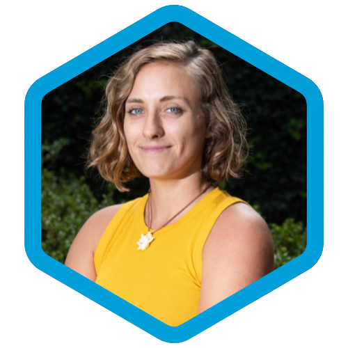
Nov 2026. By Dr. Vanessa Bézy
When we share a photo of an ocelot captured by one of our wildlife cameras, a map showing sea turtle nesting activity, or our weekly water quality results, what you see is just a small part of the work that goes into understanding and protecting Nosara's environment.
Behind every observation is a much larger process involving volunteers, fieldwork, equipment maintenance, data management, scientific verification, and analysis. It is work that happens week after week, often behind the scenes, and is essential to turning individual observations into meaningful scientific information.
As we prepare to share our annual research report, I've been reflecting on just how much work goes into collecting and managing the thousands of observations we accumulate each year, and why maintaining this continuous monitoring is so important.


From the Field to the Database
Our monitoring programs rely on a dedicated network of community volunteers, but collecting information in the field is only the first step.
For our sea turtle monitoring program, volunteers are trained to walk designated sections of Playa Pelada and Guiones, documenting signs of turtle activity and potential threats, including dogs, vehicles, and bonfires. When they encounter turtle tracks, they carefully photograph the tracks and surrounding area, allowing us to identify the species and determine whether the turtle successfully nested, abandoned the attempt, or whether the nest may have been illegally taken or disturbed.
Each observation is submitted through an online form, reviewed to verify the identification, and entered into our database. Over time, these individual surveys help us understand where and when turtles are nesting, what threats they face, and how these patterns are changing.
Our wildlife camera monitoring requires an entirely different kind of fieldwork. Installing a camera can mean hiking through dense forest, clearing vegetation with machetes, and finding a suitable tree to secure the equipment. Every camera must be carefully positioned, programmed, and documented with GPS coordinates.
And the work doesn't end once the camera is installed. Every month, we return to check batteries, replace memory cards, clean equipment, clear vegetation, and verify that the date and time settings remain accurate.
Back at the office, thousands of photographs must be downloaded, organized, and reviewed. Volunteers help identify the species in each image, and I then review these identifications for accuracy. Each photograph becomes a record containing information about the species, location, date, and time.
Some observations require considerably more attention. For spotted wildcats like ocelots and margays, we examine individual spot patterns to determine whether the same animal has appeared at different camera stations or at different times. This painstaking process has allowed us to identify individual wildcats and begin understanding how they use the landscape.
We also incorporate wildlife observations submitted by community members through iNaturalist. These observations undergo their own identification and verification process before being included in our annual analyses, expanding our understanding of biodiversity beyond what our cameras alone can detect.
Our water quality monitoring program involves yet another coordinated process, repeated every single week of the year.
Volunteers collect water samples from designated beaches and the Nosara Rivermouth and transport them in coolers to our laboratory. Another volunteer prepares the samples for bacterial analysis, carefully diluting, mixing, and sealing them in specialized testing trays before incubation.
After 24 hours, a different volunteer reads the results by counting bacterial growth in the trays. These counts are used to estimate bacterial concentrations, which I then verify before the results are shared with the public.
Our communications team transforms those results into accessible weekly updates, while the original measurements are preserved in our database for long-term analysis.
What might appear to be a simple weekly water quality graphic is actually the result of several people coordinating their efforts over multiple days.
Turning Thousands of Observations Into Scientific Knowledge
Collecting data is important, but without careful management and analysis, even thousands of observations tell us relatively little.
Every year, we bring together the information collected across our programs and begin the process of looking for patterns.
For sea turtles, we examine nesting activity, species, and threats over time. For wildlife, we analyze species diversity, distribution, and activity patterns, accounting for differences in how long cameras were operating at each location. For water quality, we examine bacterial concentrations, how frequently sites exceed recreational water quality guidelines, and whether conditions are associated with rainfall, tides, or other environmental factors.
This analysis takes many hours of work, from cleaning and checking datasets to running statistical analyses, interpreting results, preparing maps and figures, and writing scientific reports.
We then have to translate those findings into information that people can actually understand and use.
Our research is shared through annual reports, public presentations, community meetings, and discussions with government institutions and other stakeholders. We also prepare more accessible summaries so that residents can understand what is happening in their environment and why it matters.
Why Reliable, Long-Term Data Matters
One of the most valuable aspects of WCA's work is that we don't simply collect observations when a particular issue arises. We follow standardized scientific protocols and collect information consistently over time.
This distinction matters.
A single observation might tell us that an ocelot was present in a particular location. Years of monitoring can begin to reveal which areas are important for wildlife, how animals move through the landscape, and where conservation efforts may be most needed.
A single water sample can tell us whether bacterial concentrations were elevated on a particular day. Weekly sampling allows us to identify recurring contamination, investigate possible sources, and evaluate whether solutions are making a difference.
The value of this work also extends beyond WCA. The Ministry of Public Works and Transport (MOPT) have requested our input to help determine the location of future underground wildlife passages. Researchers from the University of Costa Rica have also requested our data on sea turtle nesting and water quality, demonstrating how locally collected information can contribute to broader scientific research.
And because our methods are standardized, our findings can be compared across locations and over time, making them more useful for researchers, environmental managers, and decision-makers.
This is what makes long-term monitoring so valuable: the more consistently we collect reliable information, the better equipped we become to recognize changes, understand threats, and identify effective solutions.

The Work That Makes Conservation Possible
There is something particularly rewarding about seeing years of fieldwork come together in a research report. Individual photographs, water samples, and turtle tracks begin to tell a much larger story about the environment we share.
But maintaining that continuity is also one of our greatest challenges.
Our volunteers contribute an extraordinary amount of time and effort, yet volunteer dedication alone cannot sustain a scientific monitoring program. Equipment must be purchased, maintained, and replaced. Volunteers need training and coordination. Databases must be managed, results verified, and analyses carried out by people with the necessary scientific expertise.
And this work needs to happen continuously, not just when funding happens to be available.
As we approach the end of the year, we're asking our community to help us sustain this work. Supporting WCA means more than funding a water sample or a wildlife camera. It means supporting the entire process that turns those observations into knowledge, and that knowledge into action.
Because protecting Nosara's environment requires more than knowing what is happening today. It requires understanding how things are changing, why they are changing, and what we can do about it.
And that understanding is built one observation, one volunteer, and one day at a time.
Help us keep the science going. Get in touch to support WCA's year-end fundraising campaign and help ensure that the monitoring, research, and conservation work our community depends on can continue.


Comments